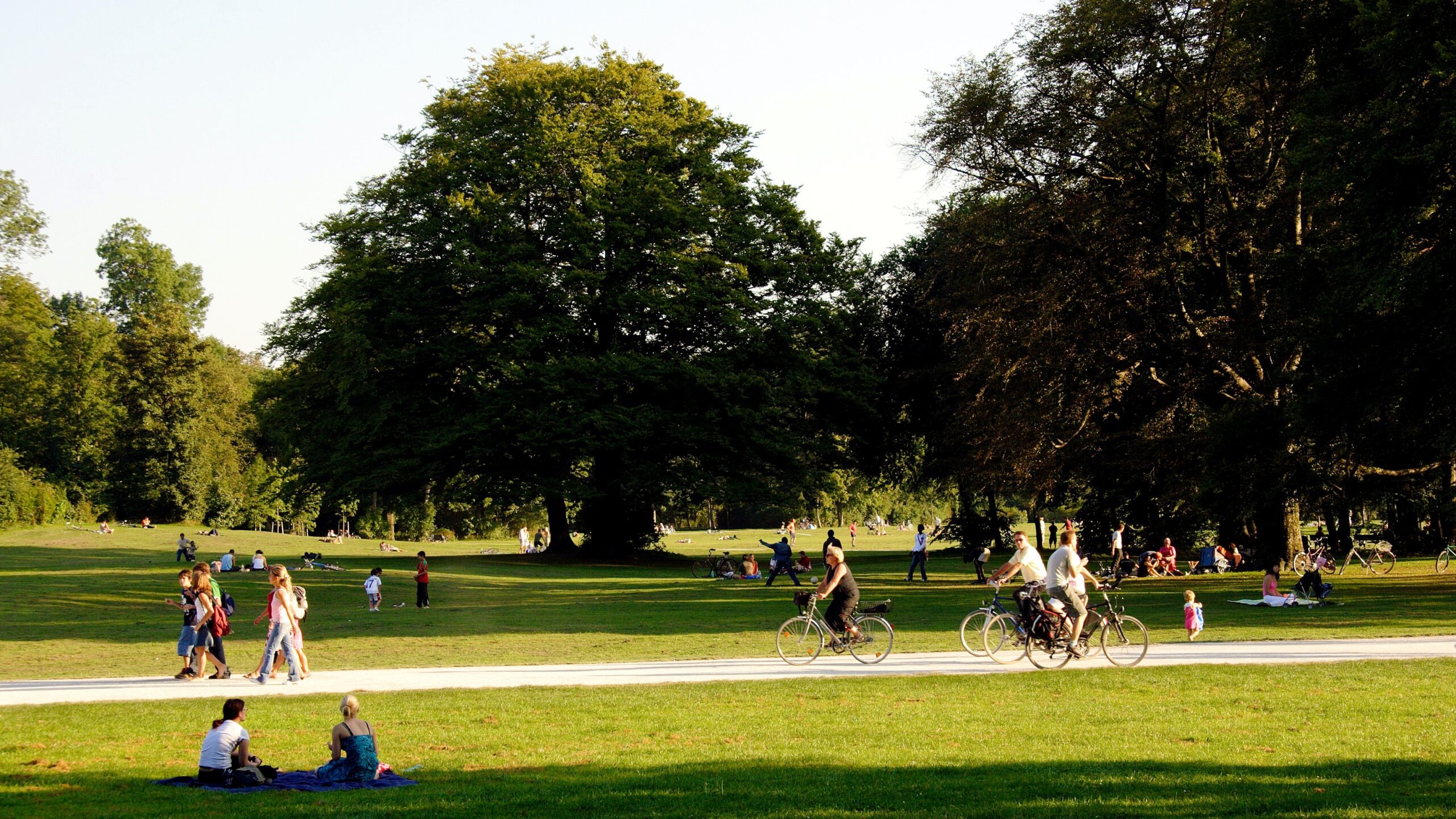
People need and want nature in their lives. Our technological advancement has made us blind to the changes that happen in our cities. The road to industrial development has led to a decrease in green infrastructure inside cities. While a country or city may have a high green space per capita index, it is also important that the green space is accessible since it must be near the citizen. That means that everyone should enjoy nature within walking distance, and not have to travel long distances for recreation. There is no doubt that cities must become greener places. Therefore, we need a plan to properly manage the green infrastructure in a city. How can we use technology this regard?
How do you define urban forests and green infrastructure?
According to the Blueprint for Innovation in Urban Forestry, green infrastructure represents a strategically planned network of natural and semi-natural areas with other environmental features designed and managed to deliver a wide range of ecosystem services in both rural and urban settings (EEA, 2021). In the same report, we can find the definition of urban forests, which are tree-based urban ecosystems comprising all woodlands, groups of trees, and individual trees located in urban and peri-urban areas. Therefore, urban forests include forests, street trees, trees in parks and gardens, and trees in derelict corners (FAO, 2017). On the other hand, a green space in an urban environment is an area of grass, trees, or other vegetation set aside for recreational or aesthetic purposes.
What is the current status regarding urban forests?
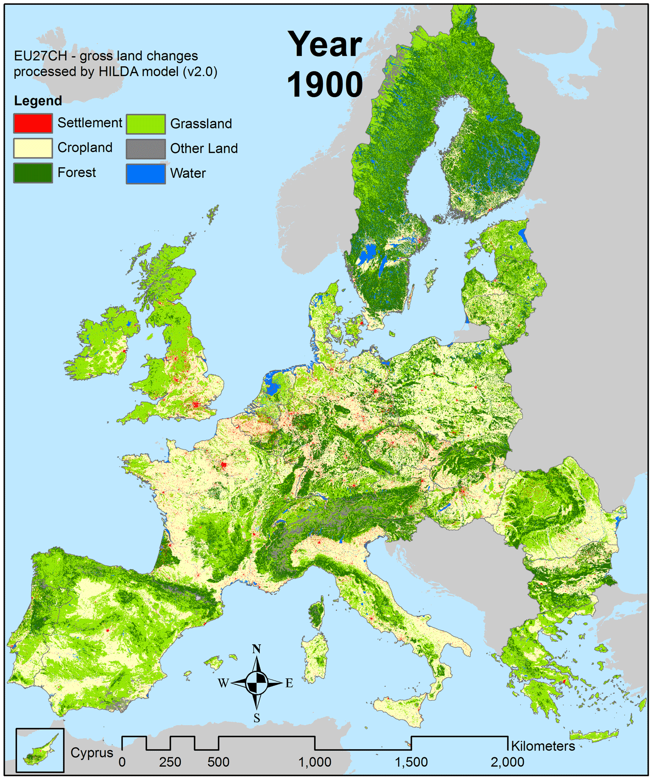
Figure 1. Europe land change timelapse (Credits Richard Fuchs, University of Wageningen, 2014)
The high migration towards cities is influencing the urban planning in detriment of the green infrastructure. Urban developers invest in buildings and to obtain as much space as possible, they sacrifice green spaces. But is the green spaces a loss or an investment?
According to the Uforest report “Unlocking the Potential of Urban Forests“, which contains different examples, green spaces can represent a good investment. The case study of the city of Lisbon shows that street trees provide services worth of €8.4 million annually, with a maintenance cost of €1.9 million annually. This means that for each €1 invested in urban forestry, there is a return of €4,5 (Uforest report).
In recent years, urban forestry got an increase in attention from policymakers and politicians as a nature-based solution for some of the key social challenges (Uforest report). Due to the densification of cities, the need of urban populations for more green infrastructures is rising, also in connection to health and recreation needs. In addition, urban forests can greatly contribute to many European Union’s initiatives, such as the Green Deal, the EU Biodiversity Strategy and the EU Urban Agenda.
According to European Environment Agency (EEA), in Europe the green infrastructure accounts for – on average – the 42% of the total city area in 38 member countries. The greenness of European cities has increased by 38% over the last 25 years, while globally it has grown by 12% over the same period (EC JRC, 2018). The growth of European’s urban greenery can be seen in figure 1, which presents the work of Richard Fuchs, from the University of Wageningen.
Forest Design implications in Urban Forestry and Urban Green Spaces
As green infrastructure is growing, it is important to decide how to manage these areas, also with the use of technology. Decision-makers and residents can better plan where to plant new trees, which species are best suited to the local context, and how to conserve and manage existing woodlands and street trees as a result of accurate maps of an urban forest over time. In determining future needs and the spatial distribution of the urban forest, a map of all trees within the city can provide a detailed, real-time inventory.
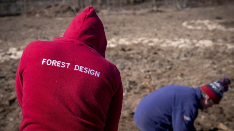
Forest Design, one of Uforest’s partners, uses different technologies, either private or public, to map and monitor the current state of urban green infrastructures and manage urban forests sustainably. In a city, there are complex interconnected demographic and environmental layers, such as diseases, heat, flood, pollution, density, and others. Planners need to take into account all these different layers when managing the city, as well as the relationship between urban forestry and healthy, resilient communities. To make their job more efficient and to serve the community’s interests as effectively as possible, technology can be extremely functional. The following are some of the most useful tools and software for urban forestry, may of which are free:
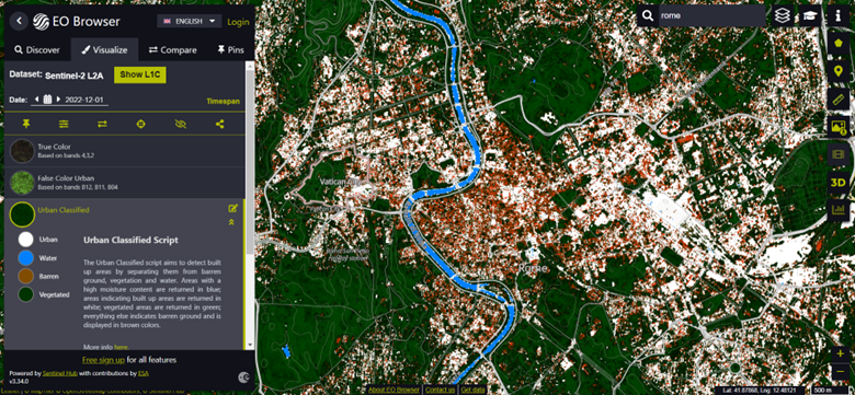
Earth Observation Browser
On short, EO Browser is a collection of full resolution satellite imagines from the data of the Sentinel program. It can be used to monitor the land changes within cities all across the globe and to create timelapse images in high resolution. These images can also be used in more advance programs, like GIS applications.
Figure 2. EO Browser visualization of Rome, Italy with “urban classified” filter
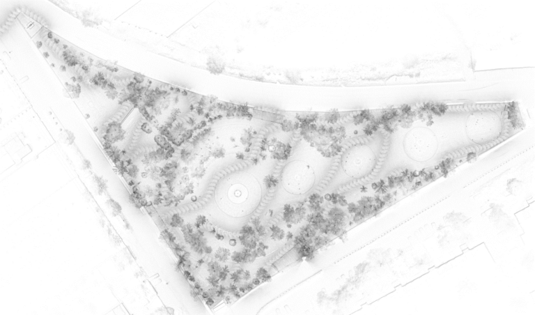
LiDAR LiDAR devices are also used to map entire streets, building areas, parks, and others. It works like a spray can, mapping everything detected into a 3D digital twin. The picture below (Fig.3) shows a park scanned with a LiDAR device, where one can straightforward see the trees, the fountain, and all the greenery present there. Moreover, LiDAR can also serve as a basis for future planning of the area. From the perspective of urban forestry, LiDAR provides high-resolution data on forest tree height that can be related to essential forestry variables (e.g., forest biomass).
Google Google has many products like Google Earth, Maps and Street View, that can help visualize and analyze the urban green. For scientific analysis and visualization, Earth Engine provides free access to geospatial datasets. Satellite images are stored in Earth Engine’s public data archive, which includes historical images spanning back over forty years. In addition to analyzing forest and water coverage, Earth Engine allows you to create custom algorithms that map the land-use change surface of cities. The Earth Engine provides easy, web-based access to satellite imagery and other geospatial data in an analysis-ready format. Combined with scalable compute power backed by Google data centers and flexible APIs, this data catalog makes it easy to integrate your existing geospatial workflows seamlessly which allows you to perform advanced analysis and visualization. Google Maps is probably the most popular mapping application in the world. It offers satellite imagery, aerial photography, street maps, and 360° interactive panoramas. Google Street View is a very helpful tool when it comes to urban planning, as it provides a view of the terrain on the ground. As well, Google satellite images provide a history of urban development over time.
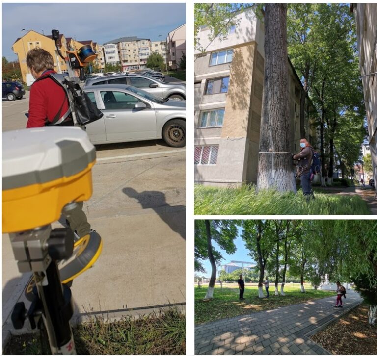
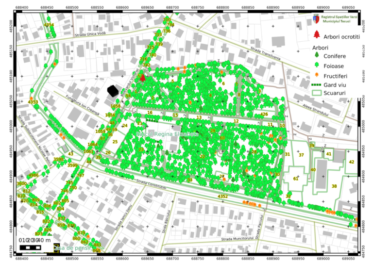
Urban registry application A green infrastructure registry is being developed by Forest Design to help improve green infrastructure. Multiple steps are involved in this process, of which the best known are field measurements and the urban registry application. While we can gather data from satellites, the highest quality results come when remote sensing is combined with ground data. Therefore, Forest Design collects information about each tree, including its height, diameter, health status, care status, GPS location, species, number in the square, risk of falling, potential damage if the tree falls, etc. In addition, every square or green space is surveyed for its facilities (sewage, sprinklers, electrical wires, and water pipes), the purpose of its utilization (green areas, alleys, fountains, etc.), the surface conditions, and what it contains (trash bins, flower beds, benches, decorations, etc.).
The registry of green spaces is a geographic information system (GIS), which contains a GIS database and a special interface for operating data, reports, and maps. The registry is a Forest Design branded web mapping application based on QGIS, PostgreSQL, and Geoserver applications. It’s a dynamic system, therefore the data collected from the field is directly linked to the data and map management system, being updated in real-time based on the changes made. When the data collected in the field is entered into an appropriate form, based on GIS information stored in PostgreSQL databases, it is classified and a visual representation of each tree, hedge, square, etc., is generated. In this application, the trees, hedges, and shrubs in the square are presented in detail in a specific format.
Figure 5. Urban green registry management platform
Future of urban forests
One of the most important challenges is that we have to ensure that the greening of our cities is becoming reality. Tree planting campaigns are a meaningful way to leave your mark on city streets for many decades because planting a tree is one of the most rewarding things you can do. The future of our cities green infrastructure is in our hands!